

Our region
The Cape York NRM region (137,000 km2) extends north from the Mitchell River catchment to ‘The Tip’ of Cape York Peninsula. It encompasses diverse landscapes including 16 complete river basins with their systems virtually unmodified (the Annan River being the exception). The region contains 30 broad vegetation groups including 72 different types of rainforest comprising 20% of Australia’s remaining rainforest.
Explore our region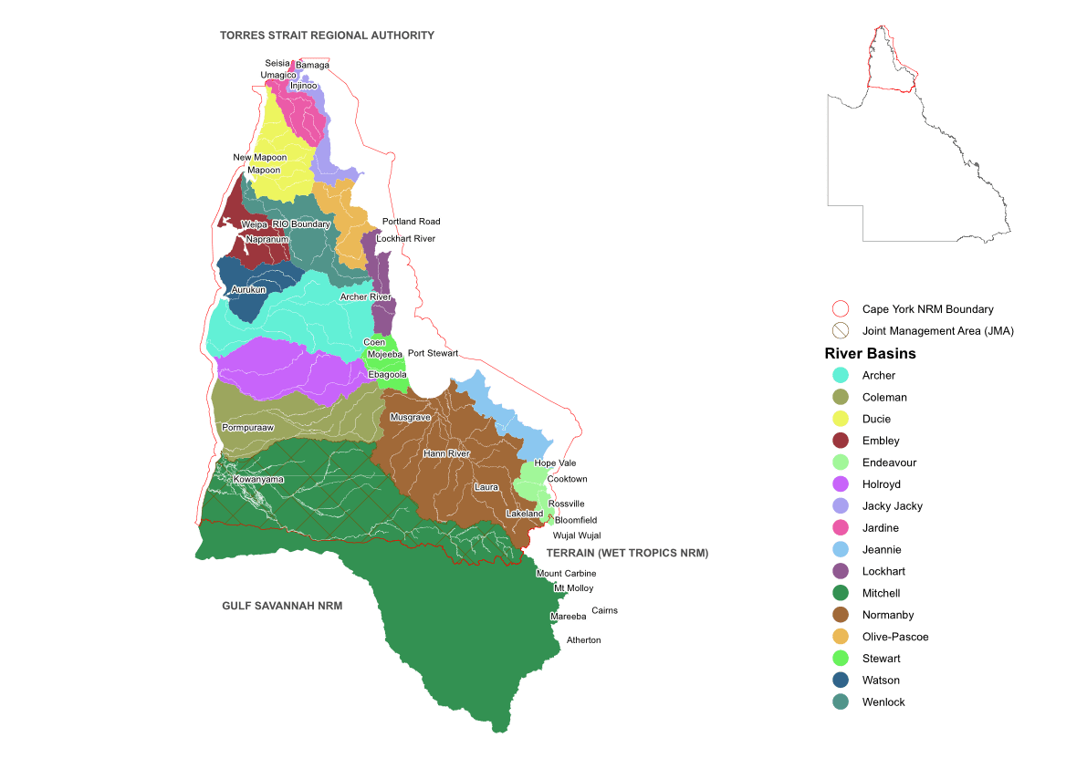
Latest News
02
May
Bromley re-introduces traditional fire management
Traditional Indigenous burning practices have been successfully reintroduced into the Bromley Indigenous Protected area to maintain and restore habitat for threatened species, particularly the beloved Palm Cockatoo.
02
May
Fire workshops skills fine-tuned
Land Managers in the southern Cape York Peninsula region were able to fine-tune their fire management skills when they attended two workshops in Cooktown last month.
02
May
Weeding out Gamba a win during the wet
Improved treatment knowledge, reduced density and revegetation success were among the positive results of the annual Gamba Grass Taskforce weed eradication program held in the Cook Shire last week.
02
May
When welding works for turtle protection
Land and Sea Rangers from Pormpuraaw and Kowanyama have taken their welding skills to the next level, by learning how to build aluminium cages used to protect turtle nests from predation on the western Cape York Peninsula.
Upcoming Events
There are no upcoming events. Please check back later.
View more